Niwot's Challenge 2021
On Saturday April 17, 2021, the 8th running of Niwot’s Challenge commenced. My race report follows.
- What is Niwot’s Challenge? Niwot’s Challenge (aka “Niwot’s”) is a footrace inspired by the Barkley Marathons. Competitors must navigate an off-trail, bushwhacking, difficult, vert-intense, course using map and compass alone. See the Official Course Website.
- How long is Niwot’s Challenge? Niwot’s length has changed over the years. The 2021 edition has two unique 25 mile loops (“Burn” and “Chiefs”) that must be completed in under 30 hours to achieve “Chief” status. After completing the Chiefs loop, one can choose to turn around and do both loops in reverse to achieve “Diety” status.
- When is Niwot’s Challenge? On the weekend closest to 4/20. In proper Colorado form.
- Who directs Niwot’s Challenge? Sherpa John Lacroix (“Sherpa”) is the race director.
- Where is Niwot’s Challenge? Somewhere west of Denver, CO. Seriously, this is kinda a secret. I will be redacting location and trail names from this report.
- Where can I read more?
The Course
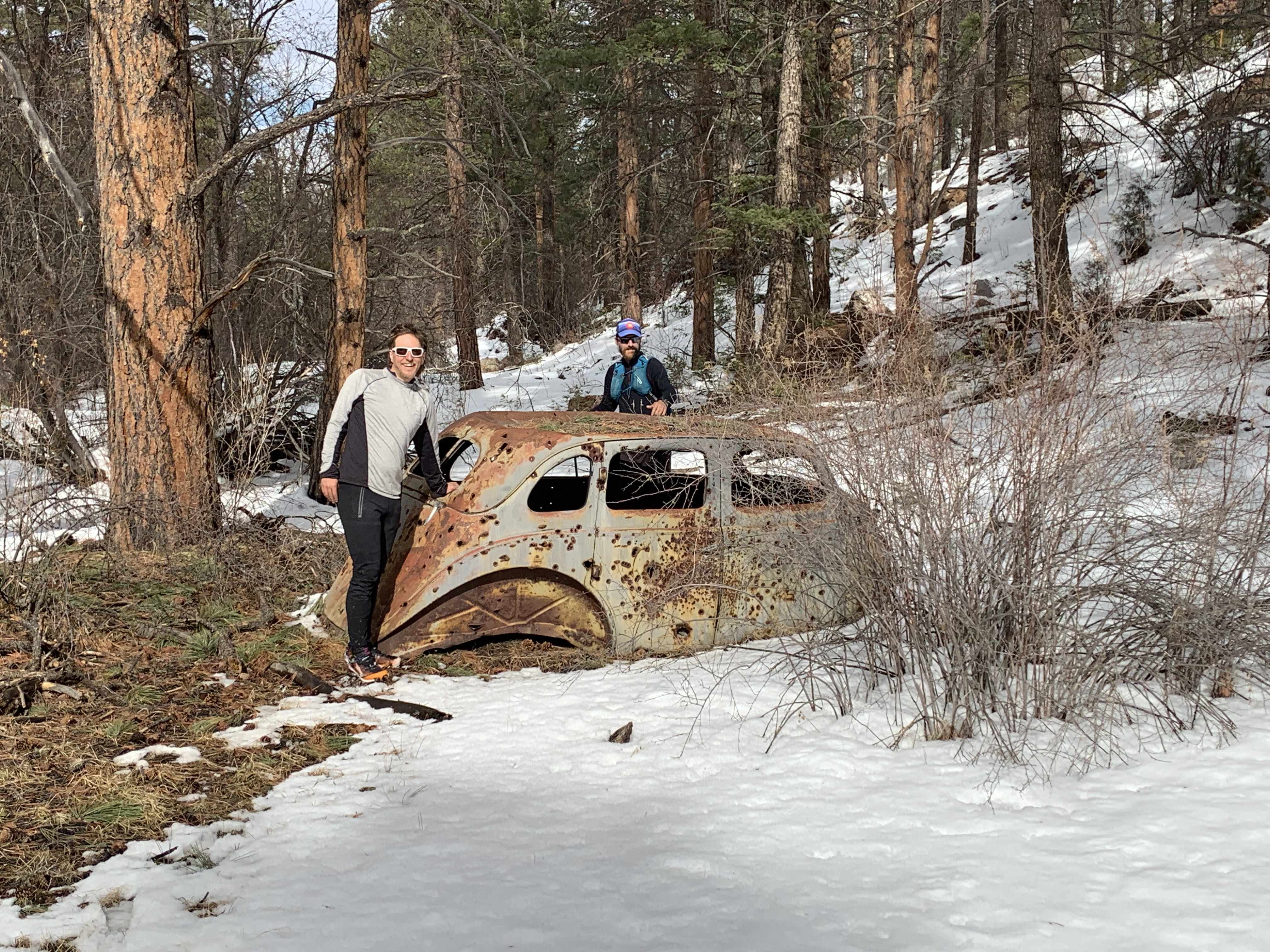
Due to some trespassing issues with some landowners who’s property we were unknowingly crossing during the previous editions of Niwots, this years course saw a massive change. The entire Suffer section is gone. Suffer was an incredibly difficult 13 miles of scrub oak and pain that usually took between 6 and 12 hours to complete. I was relieved at never having to climb the two peaks on Suffer ever again. (Notably, it was on Suffer in 2019 where I lost my map and pages and was left alone to get back to camp, only remembering one compass bearing that would get me back, eventually leading to my Chief’s name: Chief One Bearing.)
With Suffer gone, Sherpa made it his mission to convert the Burn loop, previously the “easy loop,” into a 25 miles of difficult terrain. He withheld all information on the changes in his secretive emails.
I joined the first group scouting mission onto the new Burn’s northern section to learn that the new loop was going to be quite difficult. I went to two more book setting outings to learn the rest of the loop’s southern section. I learned that in total, the new Burn loop was going to be the physically hardest 25 miles in Niwot’s history. Sherpa had put together a masterpiece. Burn involves seven major climbs and descents, totalling over 11,000 feet of vertical climb, 4 miles of difficult to traverse drainages, 2+ miles of “side-hilling” (that is, walking across steep slopes), cacti, snow, deep snow, more snow, two named peaks, and heat. Initially, I theorized that the loop wouldn’t be completable in perfect conditions in under 14 hours.
Training and Scouting
Coming into the year, I wasn’t in the best shape, so I took most of January to build some milage and run flats. Upon receiving confirmation of entry into the race in late January, I immediately started building my vert base. At the same time, I went out on the course as much as possible to learn the new parts. I learned from Chief Wrong Way last year that the best way to be good at Niwots is to learn the couse by heart. With so much new terrain, it was important to be out a lot.
In late January and Febrary, I was able to get back into training form, climbing on average 10k vert per week with lots of Bear Peak ascents and Niwots scouting trips. In March, I put in a good 4 weeks averaging closer to 15k per week with multiple back-to-back long outings. Overally, by race day, I felt in quite good hiking shape.
I got out on course 7 times total, all but one on the Burn loop. I attempted two complete loops but bailed due to time on both (darn you Burn!). But, by race day, I had seen every inch of Niwot’s in both directions. I was ready.
Pre-Race
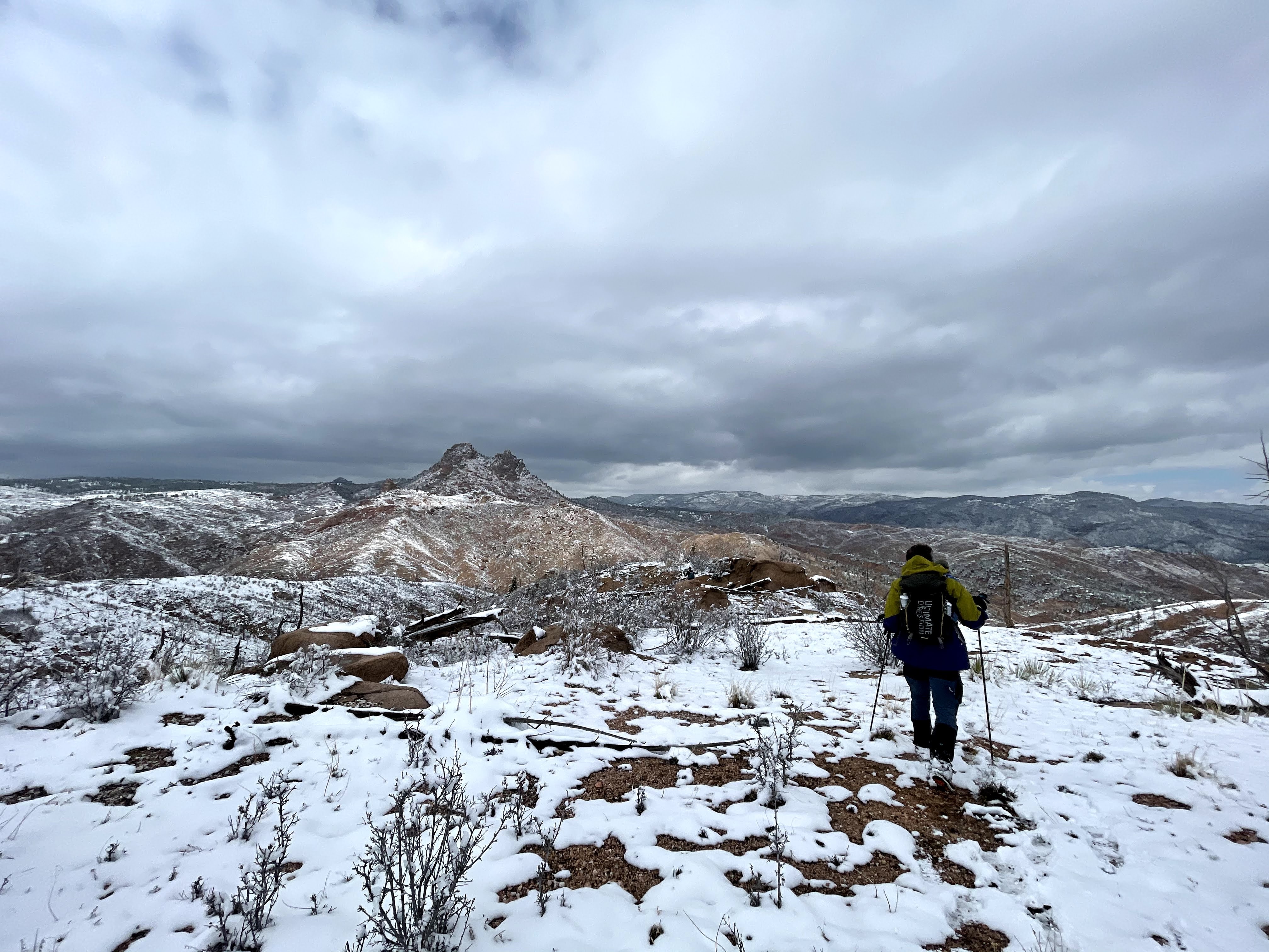
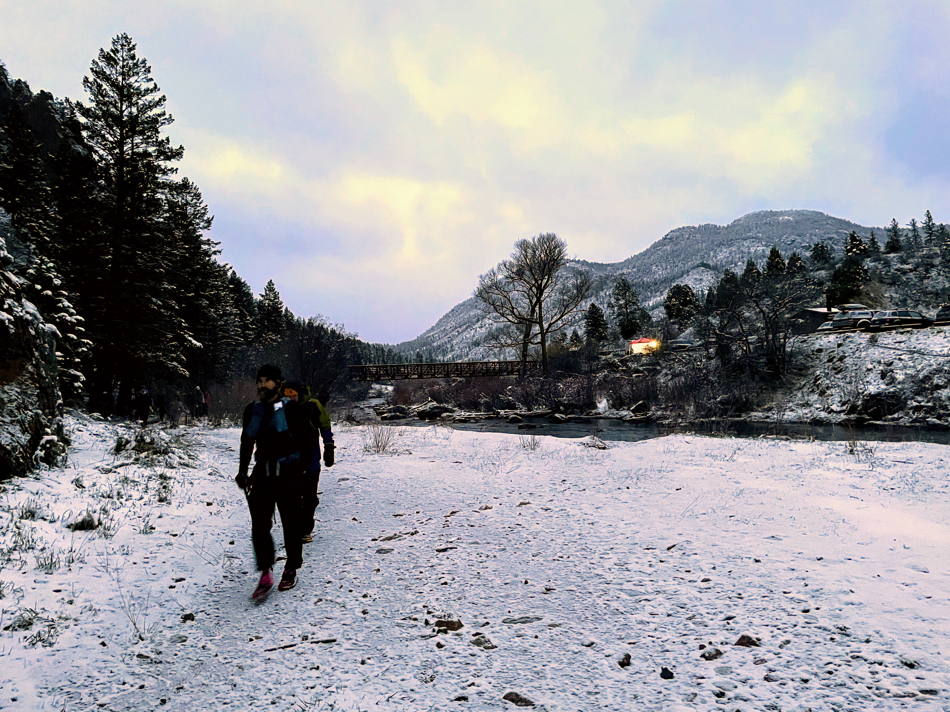
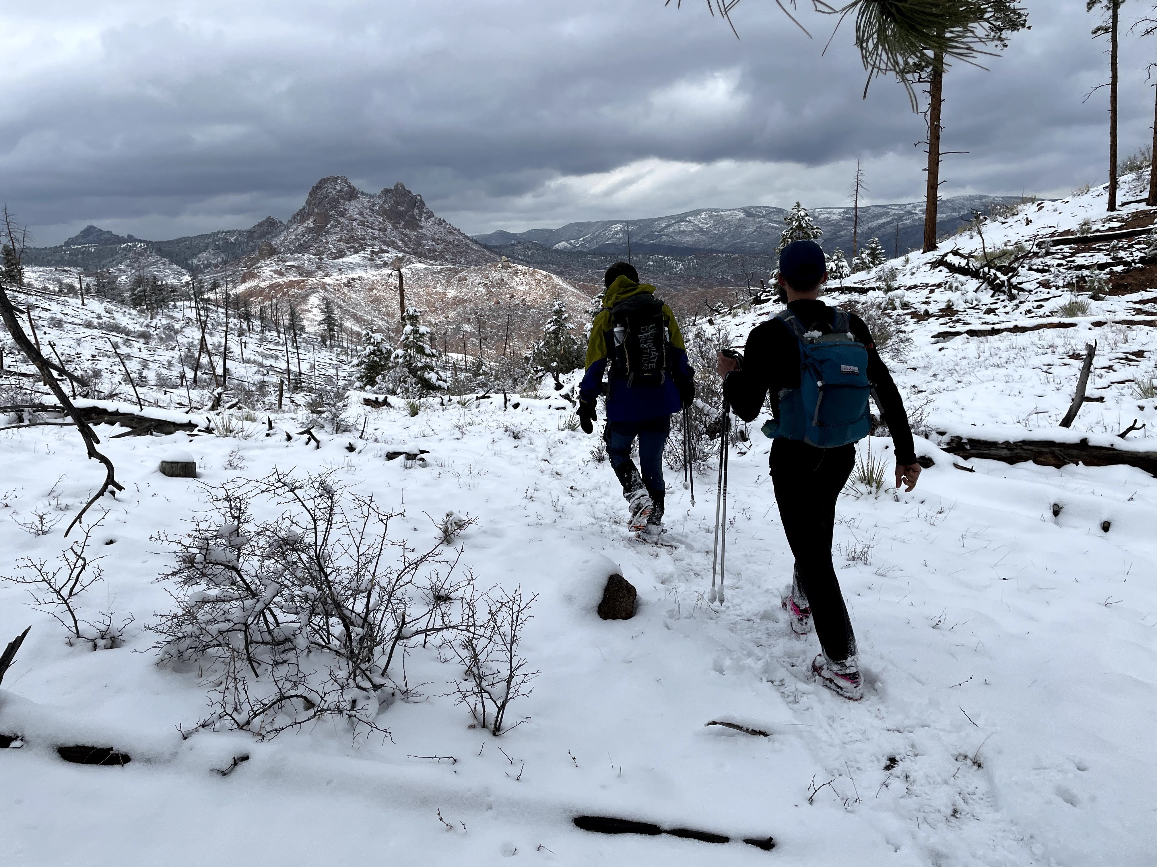
The week before Niwots always creates a lot of anxiety for me. Niwots takes so much planning, packing, scouting, and preparing that all comes down to a single effort. I put a lot of pressure on myself to make it worth it. Unfortunately, the weather had other plans for Race Day. The day before we got 6 fresh inches of snow on the course. On Saturday, the high was in the 30’s and the low in the teens. It was going to be a cold one.
I got to the start/finish the night before and parked next to the RD. A close spot isn’t too important, but its nice to be close to the action. It was cold and none of us wanted to hang outside. Some of us camping pre-race got into a car together and chatted nervously. Brandt suggested that we should aim to complete Burn in 14 hours. I scoffed at the notion, believing 16 hours was the best I could do. After eating and hanging out a little bit, I went to sleep early in my car.
I woke up at 4:30 and started getting geared up.
Gearwise, I wasn’t prepared for a wet race day. During the scouting missions, I had hiked in wet feet for twelve hours at a time, which had created some hot spots on my feet. So in an effort to avoid this for possibly much longer on race day, I did the thing you’re not supposed to do: I tried something new on race day. I put plastic bags in between my sock layers in my shoes. Let’s see how this turned out.
Also, I wasn’t really sure how cold it would be up there. It could be 15 and snowing or 36 and partially sunny. Dressing for the day was difficult. I ended up bringing a bunch of layers: wool baselayer, tough waterproof layers on top of that.
At 5:30 we had the drawing of lots to see which direction on Burn we’d have to run that day. I wasn’t too concerned as I could navigate either and left it up to the Niwot’s gods to decide. They were kind and gave me my preferred route, clockwise. This meant that after book 1, I’d have to get Books 2-14 in reverse order.
Race
At 6am, Sherpa lit his Gandalf pipe and I headed off at a quick hiking pace up to Book 1. I found myself next to Brandt. Since we’d trained together so much, I knew we’d try to stick together, but I’d have to keep up with him to do that. We headed up the trail. At the correct junction, I turned up the ridge and climbed up to Book 1. I was already too warm and had to strip layers on the first climb. I grabbed my page and descended back to the trail and ran to catch up with Brandt. A hundred yards more and I found the descent past the old car in the drainage. I ran to catch up with the group and eventually caught them at the bottom, where Book 14 was. I had to strip more layers off. (Wow did I mess up this gear situation!)
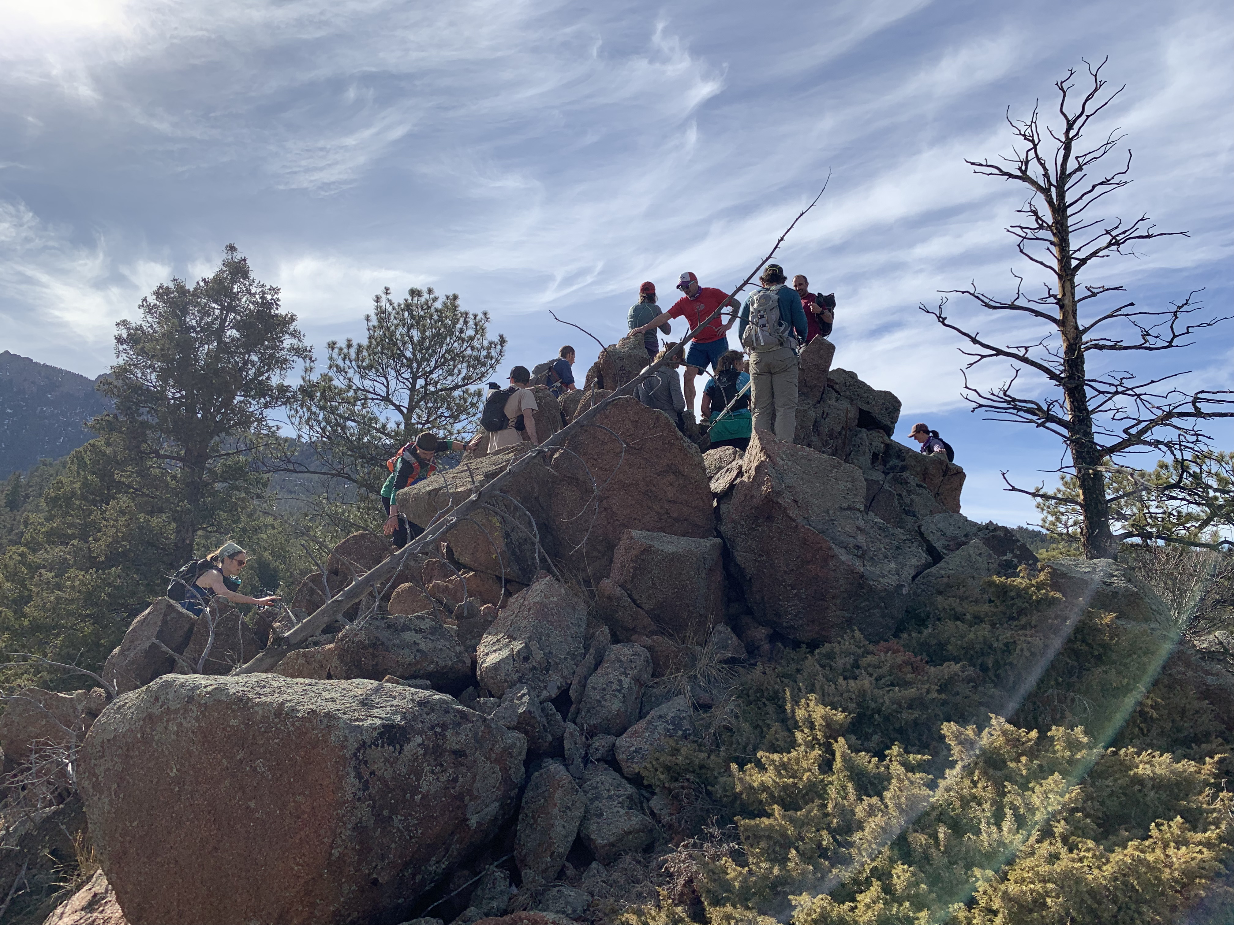
We now entered the “Three Stooges” area of the course. We climbed up Moe for our first real climb. I was determined to not stop very much (outside of delayering of course). So at the top when everyone was consulting maps, I remembered to turn opposite the barbed wire fence and just kept on hiking and running along the ridge down to Book 13. I was slightly off hitting the lone aspen book, but found it quickly enough before anyone had caught up to me. I grabbed my page and soon a whole group showed up. We had seven of us together there. Four were just trying to stick with Brandt, John Clarke, and I. JC and Brandt and I had trained on the course many times and knew it quite well. We ate a snack and headed up Curly.
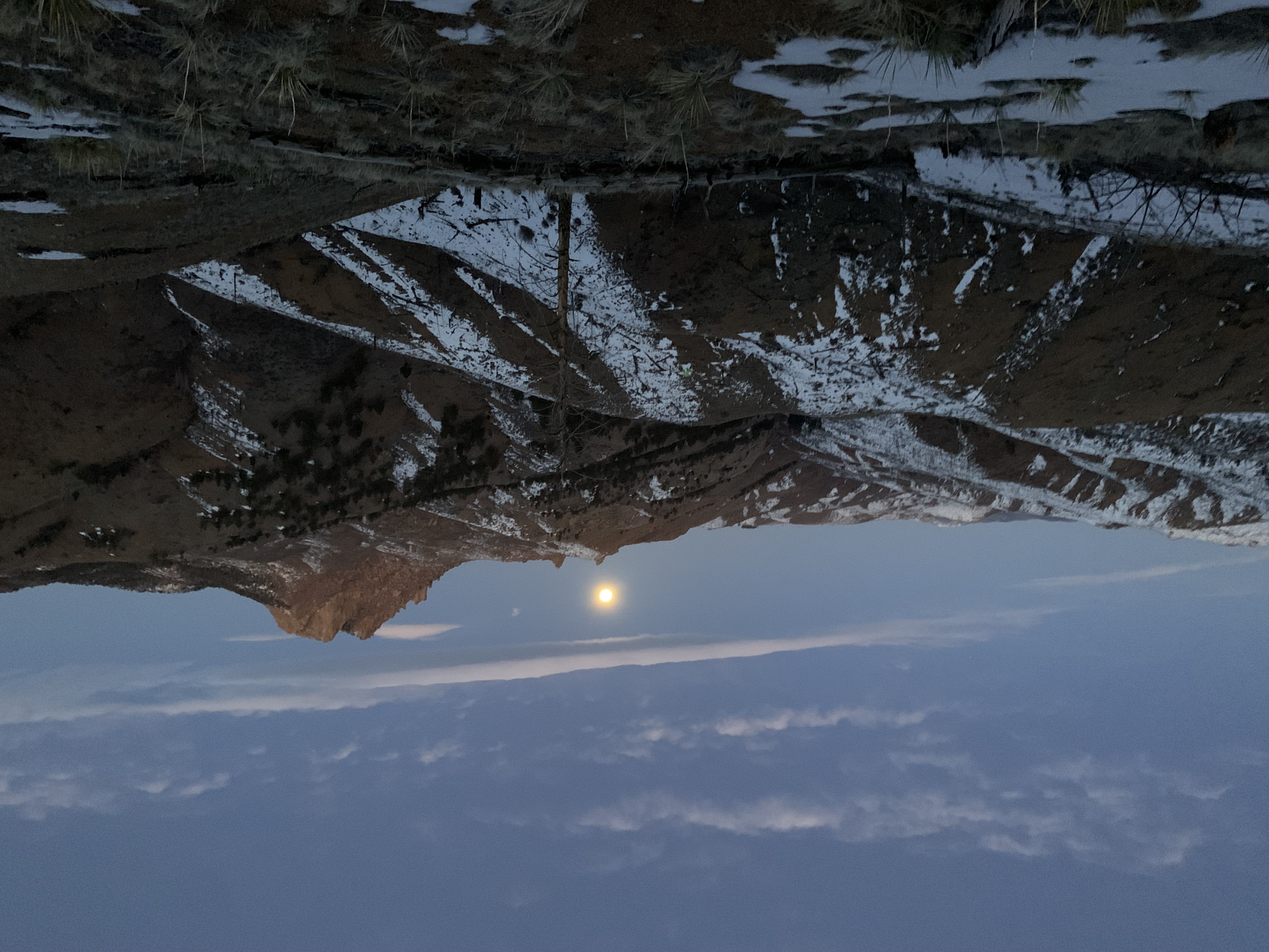
Curly is pretty easy if you go all the way to the summit, which it so happens is easy not to do. I made sure we went all the way to the summit. The group took a break at the top. I didn’t want to encourage slower travel so I just started desending. This is around the time that I realized I had lost my compass and brought the wrong map, so I had to rely on my intuition and memory alone. Luckily, those are my two best navigational attributes. I found the right ridge easily enough and descended directly to Book 12. The group was hot on my heels and we headed up the final stooge, Larry. Now Larry is actually a No Fuck Up zone where messing up is quite difficult. We navigated up and down and up again successfully all the way to Book 11. We found the book, ate a snack and headed up the Spine to Never Never Land.
This is around the time that I realized I had lost my compass and brought the wrong map, so I had to rely on my intuition and memory alone.
Never Never Land is a navigationally difficult area of the course where everything looks the same and its easy to mistake which drainage or ridge you’re on. I have little tricks to navigate this area. Like knowing to look for a ridge with no descernable features. Trust me. We got across the Spine and into the Never Never Land and down to Book 10 perfectly.
Then we started contouring our way to Book 9. This is when the trouble started for me. The plastic bag situation started to cause issues. An unexpected affect of plastic bags in your shoes is a lack of friction between your foot and your shoe. This is most important when walking cross-ways across steep slopes. It compressed the side of my foot into itself and it started to hurt every step. (I was actually diagnosed with a Neuroma between my 4th and 5th digits due to this section just today.)
But despite the pain I kept leading the group across the wasteland of samey looking trees and drainages. Eventually I declared we had made it and despite some second guessing, we descended the final drainage direct to Book 9. We had made it out of Never Never Land successfully and into Key West.
From Key West, you have to take a very long, very thick, not very fun drainage for a very long time. We hiked it consistently and eventually made it to the end. I wasn’t leading this part very much as I was tired from leading the first few books.
We started the pretty easy climb up to Book 8 and the high point of the course. This climb is the steepest thing on this side of the course, climbing 1000ft in less than 0.5 miles with nothing so much as a game trail to speak of. Brandt wanted to drop some of the slower folks in the group, so we headed off together and picked the wrong hill to climb and ended up behind the rest of the group. Brandt, still determined to out-hike everyone sped up to the front to guide the group. After we ascended to a small high point, I realized we were heading in the wrong direction. I yelled out that we were too far right and needed to head left to correct and get into the chute. Brandt, in the lead, pulled the group back to the left, but not enough. Eventually we got cliffed out too far outside the chute. I argued we were still too far right, but Brandt thought he went too far left. I lost the argument and the group headed up to the right. Knowing I was correct, I headed left, but was quickly cliffed out. My choices were simple, navigate according to my intuition alone or go rescue the group. I didn’t really want to be out there alone so I went back to the group who were cliffed out even more than before. Now people were convinced I was correct and we headed back left, descending a hundred feet or more to get around the cliffs. After discussing some rock scrambling, we just decided to keep descending back to the chute. Eventually we made it to the chute, which I recognized immediately from its topological shape and absurd steepness without so many cliffs. We climbed up the hundreds of feet we had just given up and eventually made it to the ridge crest area. Tired and down from making a navigational mistake, I led the group along the ridge line I remembered well all the way to the summit where I got the book and tore out pages for everyone.
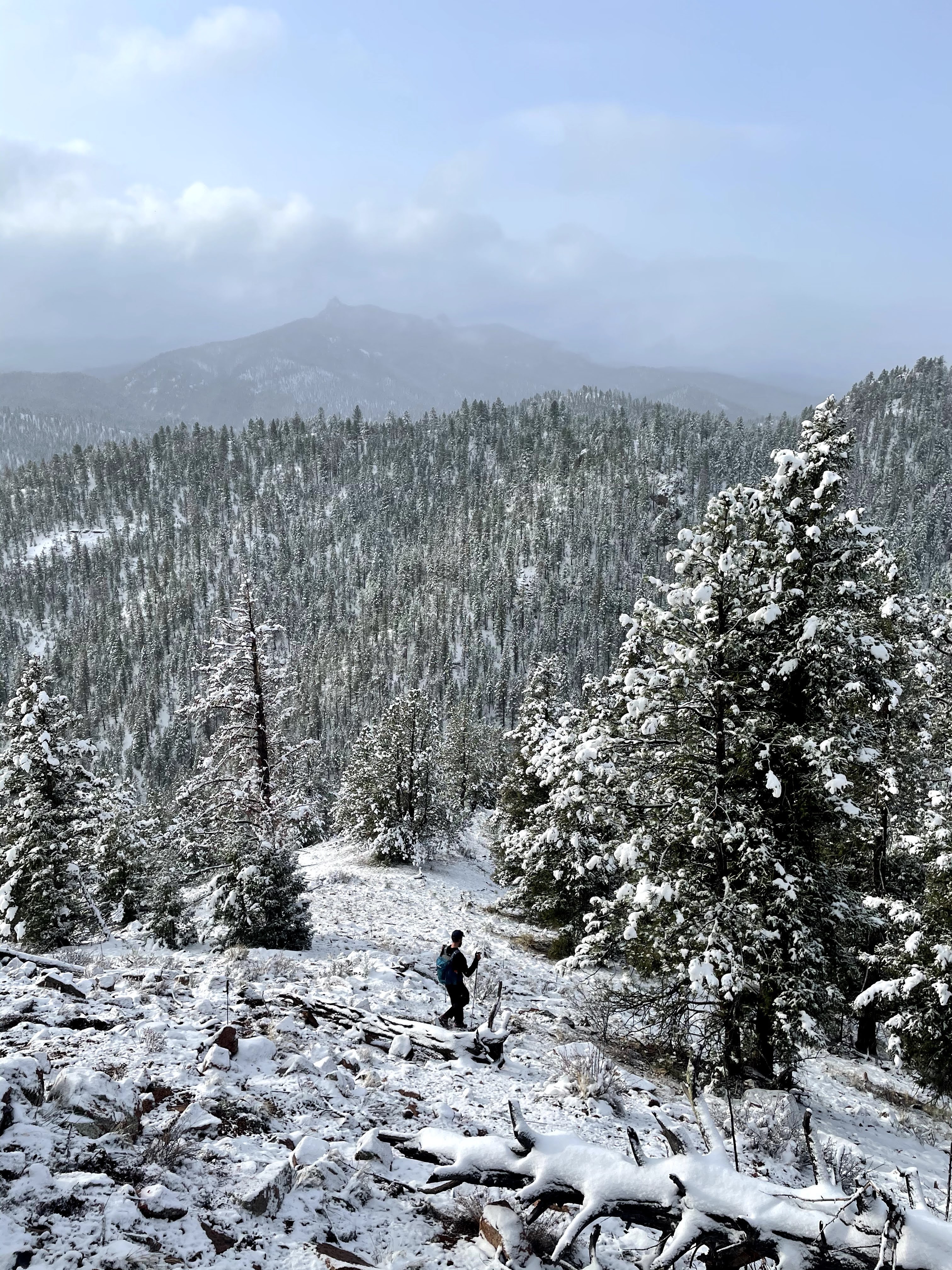
At this point, we were halfway through the course, so its a good time to take a gander at where we were and what had happened. We had made good time despite the navigational error, still less than seven hours in, we had a good shot at Brandt’s 14 hour goal. It had snowed lightly on us the whole day up til then. The entire ground was snowy and slippery. I had fallen multiple times so far. I was actually regulating temperature alright in the cold, even if I had too much gear in my bag. My foot hurt badly on all the climbs, but it wasn’t slowing me down yet. The group had stuck together through the first half at a good pace, so Brandt’s notion of dropping the slow ones was gone. At this point, we were intent on finishing the loop. You just couldn’t move too fast on all this fresh snow without hurting yourself, so we traveled consistently at a strong hiking pace.
We headed along the high ridge, dropped into and out of Quantum Rock Gulch, along the soft ridge and up to the Attic for Book 7. Near the Attic, we saw the first group heading in the other direction. They must have been at least an hour behind us to pass us this late. We easily grabbed Book 7 and I led a quick descent off the Attic that had me almost twisting my knee off a couple times. We landed slightly East on the descent and corrected by looking for Deadfall Land, a large field of deadfall. Once we found that, the road was easy to find and led us to Book 6. Near Book 6, we met the rest of the nitwits coming in the other direction. We saw Drew, who was telling a story of losing all his shit, then my ex-roommates Alan and Joe, who picked up Drew’s shit. Then the rest of the racers, all at least an hour behind the first group, so at least two behind us.
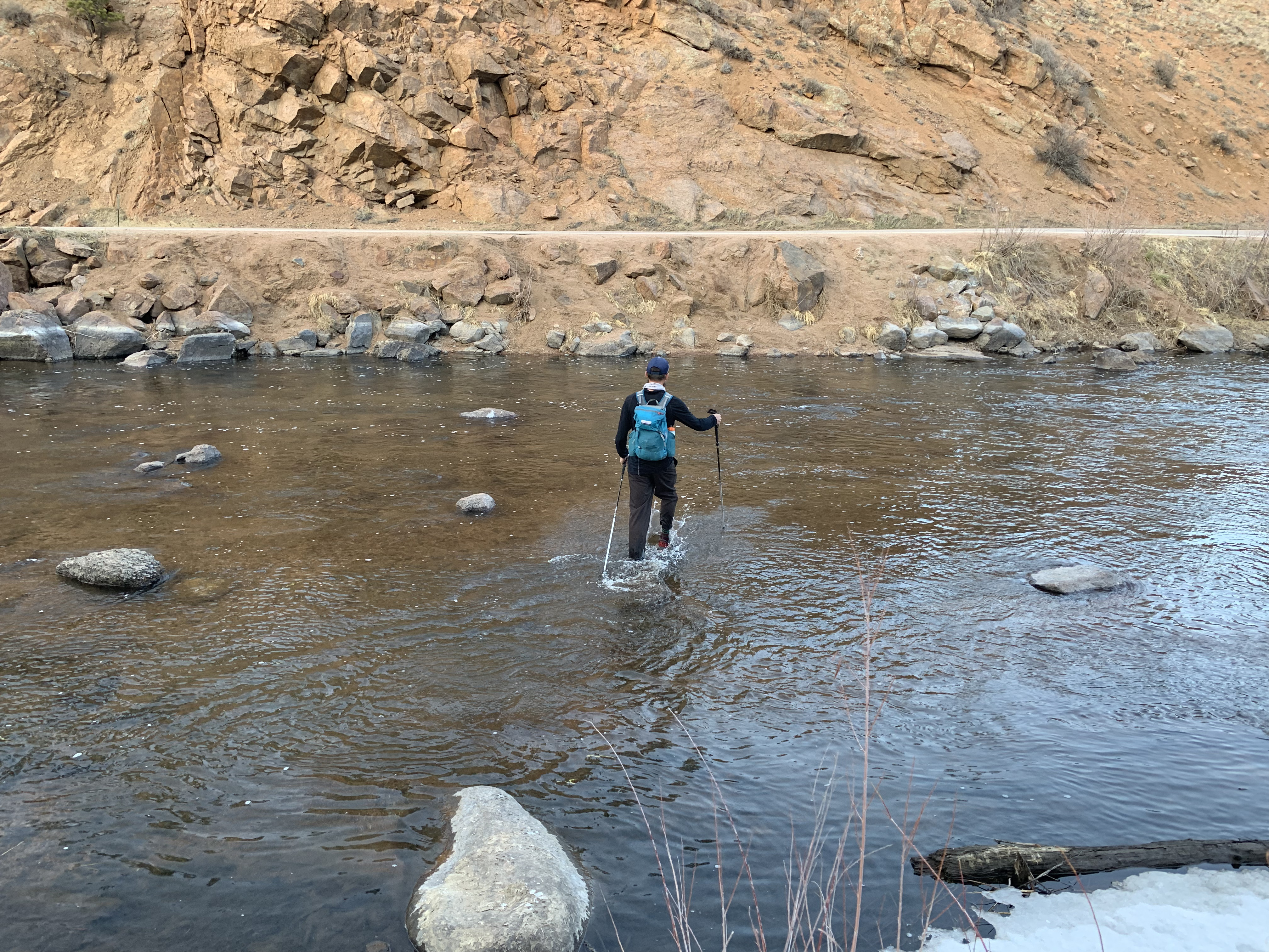
Book 6 was easy to find. It’s near a “road.” We descended the ridge all the way to the large creek. Brandt was leading and determined to set a good pace to the water where he could refill. We refilled and headed up to the iconic Book 5. I started to feel quite down at this point. I slowed and eventually took the rear. Brandt waited with the group for me. The entire group was trying to stick with Brandt and I, but I couldn’t keep up right now. I told them to go on without me. I was dropped.
I analyzed the situation: my foot hurt badly, but that was just an excuse I could use later to drop. It wasn’t going to slow me down now. Why couldn’t I keep up? I must be bonking. I hadn’t eaten enough in my desire to keep moving quickly. Also, it was getting a little warm now (like 35 degrees and sun behind the clouds) so I was sweating more. So I ate a Bobo bar, two advil for my foot, and two salt pills for all the sweating I was doing. I hiked slowly alone and eventually talked myself into hiking faster.
Book 5 is an out-and-back and I saw the group just a minute after they left the book. I went in and snagged the book page. One racer (Tim? Nick? I don’t remember his name) was there taking a picture of the view (I did say Book 5 was iconic). He stuck with me as we put down a good pace to try and catch up. Eventually we made it to Quitter’s road. That racer decided his day was done and headed back. I had quit plenty of times during training on this road. Not today. Not even if I’m in pain and alone. I’m finishing this loop.
I jogged the downs and power hiked the ups as well as I could along the road and around the rocks to Book 4. I made it there while Brandt and JC were still collecting their pages. I took a moment to eat a big bite of burrito and then caught up with them. Brandt remarked on how short I was behind for. It felt longer to me.
We navigated down Chair Rock Express to the bottom and dropped into the creek and stopped for water. Then we climbed up to Book 3. At this point, the group was straining. Brandt, always the consistent one, was out ahead with one of the Veal’s. The other Veal was in back with JC. Nate and I kept the middle. At this point I was assessing my chances of continuing onto Chiefs. I decided to delay the decision to the final descent to and climb out of Book 2.
We finished the difficult climb to Book 3, celebrated with some of the cold water we had just filled up on and continued on. This area is called New Burmuda, because of how easy it is to get lost and into the wrong drainage (hint: they’re all wrong, the course is on ridges). But in the CW direction, its actually quite easy to navigate. We found the correct ridges, the old firebreak road, and the descent to Book 2 easily. My knee was hurting for no reason on the descents. I think it was because I was trying to stay off my hurt foot. At this point I called it. I had made some critical gear errors and needed to be honest. I couldn’t continue onto Chiefs without risking more injury. I told Brandt. At Book 2, we assessed who wanted to continue. Nate said he didn’t know yet, and JC was clear he wanted to go.
So we started the final climb. Everyone was exhausted from this huge loop. Brandt made it up quickly with the Veals. I got up next and told him to go on, I’d wait for JC and Nate. Everyone got up the climb and we walked to the trail. Now just a few miles of good old groomed trail down to camp. We spread out as we all ran back.
The final miles of any long run are a special time. They are a mix of boredom and elation, relief and suffering. I enjoyed these miles, as I knew my day was done. Plus it felt great to run after a day of hiking. We got down to camp at an official time of 13:55.
I declared my day was done. I breathed. My 2021 Niwots was over.
The final miles of any long run are a special time. They are a mix of boredom and elation, relief and suffering. I enjoyed these miles, as I knew my day was done.
Results
Brandt, JC, Nate, and I completed CW Burn in 13:55. Brandt and JC headed out on Chiefs but were defeated by the cold and snow and returned to camp sometime during the night.
The Veals walked in the final miles and completed CW Burn in 14:20
Mike and Todd and a couple others completed CCW Burn in 15:30. Mike and Todd headed out on Chiefs but were defeated similarly.
Five others, going in the counter-clockwise direction, including Michael and Drew completed Burn 7 minutes over the time limit in 18:07.
Everyone else dropped for one reason or another.
Thoughts
When I think about Niwots, now a couple weeks removed,
- I remember all the fun times I had out on the course with my friends, Alan, Joe, Brandt, JC, Nate, the Veals, Mike, Sherpa, Sam, Todd, Bob, and many more.
- I think of how fun it is to navigate based on things like barbed wire fences, “ridges with no descernable features”, rocks that are in two places at once (see Quantum Rock Gulch) and particular distinct dead trees.
- I am proud of a strong sub 14 hour finish time on a very not-perfect conditions Burn. That loop is fucking hard. I would challenge any strong Barkley-style athlete to this loop.
- The weather played a large role in this year’s results, but my DNF is the result of my own preparation. I didn’t have a solution to the cold and wet. Something to work on.
- My foot is healing. I just had a dude put needles in it. It feels better.
- I’m really fit from all that vert training, so now its time to take it to more running.
- I had a ton of fun out there this year and I’m proud of my “Fun Run”.
Niwot’s won this year’s battle. But it won’t win the war. I’ll be there next year to try again. (and to see all my friends again!)